Monitoring and Regulating Induced Seismicity
The BC Energy Regulator (BCER) has taken a proactive and transparent approach to researching, recording and mitigating induced seismicity associated with resource development. Requirements are in place, including the submission of induced seismicity pre-assessments prior to hydraulic fracturing that outline real-time monitoring network and mitigation strategies, suspension of fracturing operations if seismic activity reaches pre-determined thresholds, the measurement of ground motions, and special project orders that require community engagement. The BCER routinely reviews all available data to monitor for potential occurrences of induced seismicity and has on-going research and collaboration with industry, academia and other agencies in the field of induced seismicity.
The BCER has a seismic monitoring array in northeast B.C. that is strictly focused on events in this region. This includes over 35 seismometers that record events to confirm the location and magnitude of seismic events.
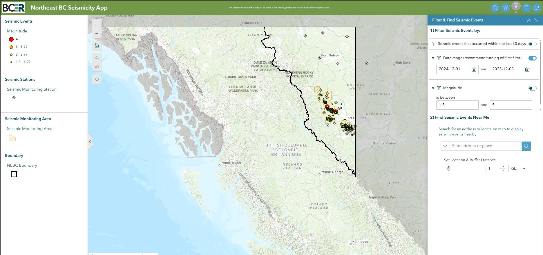
Northeast B.C. Seismicity Map
This map displays recent and past seismic events of greater than local magnitude 1.5 that were recorded in the northeast region of British Columbia along with displaying active industry operations.
Seismic events are analyzed by the BC Seismic Research Consortium, which is a joint partnership between the BCER, Geoscience BC and The BC Oil and Gas Research and Innovation Society.
The Northeast B.C. Seismicity App User Guide provides instructions on how to navigate the BCER’s Seismicity Map that provides timely information on seismic events confirmed in NEBC along with the locations of current industry activity.
Click on the map below to launch in full view:
- Local Magnitude (ML): The BC Energy Regulator has adopted local magnitude (ML) as the magnitude standard for northeast B.C. (NEBC) and for regulatory decisions. This standard was derived specifically for the characteristics of northeast B.C.’s geology. Learn more about the adoption of local magnitude determination
- Unconventional play trends: Unconventional play trends depict the general location and extent of hydrocarbon resources found in densely packed, fine-grained rock layers. This map focuses on the Montney Trend as this is the region that is the focus of over 95% of oil and gas activity in NEBC currently and the trend along which induced events are most common.
- Seismic monitoring areas: The Montney resource has been divided by the Regulator into two primary areas for the understanding of induced seismicity. These are the Kiskatinaw Seismic Monitoring and Mitigation Area (KSMMA) and the North Peace Ground Motion Monitoring Area (NPGMMA), which differ in their geological and seismic characteristics, and are separated by an area of little seismicity.
Well types:
- Disposal wells: Wells that are authorized for the disposal of waste fluids deep underground.
- Drilling wells: Wells that are currently being drilled or that are in the drilling phase.
- Fracturing wells: Wells that are being actively stimulated or hydraulically fractured in preparation for producing natural gas.